
John
Forum Member
Location:
Time of year:
Expected trail conditions:
Vehicle:
Area regulations:
Equipment recommended:
Type of surface:
Wildlife
I will be updating this thread with each trip report. Included will be pictures, trail conditions, weather conditions, etc.
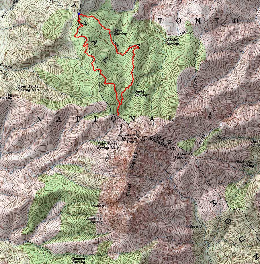
Below is a picture of Four Peaks. From the picture, you can see how it got its name.

Four Peaks (part of the Mazatzal Mountains) in Central Arizona. Part of the Tonto National Forest
Google Maps Link : https://goo.gl/maps/IHWa
Google Maps Link : https://goo.gl/maps/IHWa
Time of year:
Varies, I frequent this area year around
Expected trail conditions:
This varies from season to season. During the late summer months, heavy rain and lightning are frequent. Fall/Winter snow is frequent. During the dry summer months, trails are generally dry and pretty rutted out.
Vehicle:
1996 Subaru Legacy Outback 5MT EJ22E
Area regulations:
Most places around here are open to public use. There is one area closer to the top of the mountain that is a mine, and all that is private property. You're not "suppose" to cross that property line, but many do and have not got in trouble. There are frequent fire restrictions due to drought, so campfires, target shooting, etc are prohibited sometimes.
Information can be found at https://www.fs.usda.gov/tonto
Information can be found at https://www.fs.usda.gov/tonto
Equipment recommended:
4x4
High clearance
Firearms & Ammunition (12 gauge shotgun recommended for protection from wildlife)
Food
Water
Basic tools
Jack
Spare tire
CB Radio
Cell phone (most areas have no cell phone signal from any carrier, but a few spots get minimal T-Mobile coverage)
Tire Chains (in winter months)
High clearance
Firearms & Ammunition (12 gauge shotgun recommended for protection from wildlife)
Food
Water
Basic tools
Jack
Spare tire
CB Radio
Cell phone (most areas have no cell phone signal from any carrier, but a few spots get minimal T-Mobile coverage)
Tire Chains (in winter months)
Type of surface:
Trails range from easy to extremely difficult. There are some places that your average front wheel drive passenger car can go through at slow speeds, but they are few and far between. Most areas 4x4 and high ground clearance are recommended. Some of the more difficult trails require 4x4 and lots of off road experience. During the winter months, all the trails require 4x4 and tire chains are suggested.
Wildlife
There is a risk of running across dangerous wildlife in this area.
Since the desert is home to many poisonous / dangerous animals and insects, proper precautions must be taken. Its always good to carry Benadryl (allergy medicine) because it helps counteract scorpion venom. It can help buy you enough time to get to help if you were stunk. As well, some sort of firearm is recommended. Most animals will keep their distance from you, but if one is hungry enough it could be a disaster. A lot of the time you can just fire one round and it will scare the animal away.
- Mountain Lion
- Black Bear
- Javalina
- Coyote
- Western Diamondback Rattle Snake
- Scorpion
- Wolf Spider
- Black Widow
- Tranchula
- Skunk
- ETC
Since the desert is home to many poisonous / dangerous animals and insects, proper precautions must be taken. Its always good to carry Benadryl (allergy medicine) because it helps counteract scorpion venom. It can help buy you enough time to get to help if you were stunk. As well, some sort of firearm is recommended. Most animals will keep their distance from you, but if one is hungry enough it could be a disaster. A lot of the time you can just fire one round and it will scare the animal away.
I will be updating this thread with each trip report. Included will be pictures, trail conditions, weather conditions, etc.
Below is a picture of Four Peaks. From the picture, you can see how it got its name.
Last edited:

 .
.") .
.
